GEOD
origin
Modifying the origin of the cross-section with the origin command
The origin command is used to shift the origin of the coordinate system in the cross-section display window.
By default, GEOD places the origin point, with coordinates x = 0 and y = 0, at the lower-left corner of the drawing window.
The position of this origin point may be shifted by calling the origin command with the following syntax:
origin dx dy
where dx and dy are the horizontal and vertical shift parameters of the origin point, expressed in metres.
If dx > 0, the origin is shifted to the right; conversely, if dx < 0, the point is shifted to the left.
Similarly, the point is shifted upward if dy > 0, and downward if dy < 0.
One will often need to shift the origin upward when constructing a cross-section, in order to match the figure scale to that of the section. For example, for the 1:50,000 cross-section shown in figure 1 below, the following instructions were used:
  unitbase 5
  origin 500 750
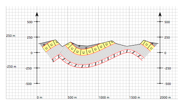
Figure 1 : Geological cross-section with the origin point shifted relative to the lower-left corner of the drawing area by means of an origin 500 750 instruction. The horizontal and vertical shifts specified by the origin command are expressed in metres.