GEOD
resolution
Setting the resolution with the resolution command
The resolution command is a general command used to control the rendering quality of the cross-section.
GEOD uses a number of intermediate points to draw its curves. The more intermediate points a curve contains, the better the rendering will be, but the longer the calculation time will also be.
On the other hand, in some cases, a small number of intermediate points is sufficient.
The resolution command is used to adjust this number of intermediate points globally for the whole figure. Its syntax is:
resolution f
where f is the minimum distance that must separate two intermediate points.
Consequently, to improve the rendering, with a longer computation time, one decreases f. Conversely, if one wishes to limit the number of intermediate points, one increases f.
By default, the resolution parameter is set to one metre. This parameter may also be modified in the Curves panel of the Preferences window.
Note:
The cross-sections below are drawn on a grid at a scale of 1:50,000 instead of the default 1:10,000 scale, by applying a unitbase 5 instruction. Therefore, to obtain the true resolution value, expressed in metres, actually applied to the drawing, the value specified after the resolution command must be multiplied by 5.
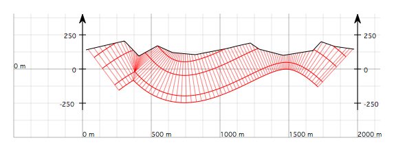
Figure 1 : Geological cross-section drawn with the default resolution of 5 × 1 metre and displayed in *debug* mode.

Figure 2 : Same cross-section, but with a resolution of 5 × 5 metres, using resolution 5. The drawing remains acceptable.
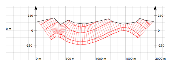
Figure 3 : Same cross-section, but with a resolution of 5 × 20 metres, using resolution 20. The rendering of the cross-section is degraded.