GEOD
scale
Zooming the cross-section with the scale command
The scale command is used to distinguish the horizontal and vertical scales.
It is sometimes tempting to draw cross-sections with a vertical scale different from the horizontal scale, especially when the topography is rather flat. Although this is not recommended, because it distorts the objects, it is possible with the scale command.
The scale command uses two parameters:
scale sx sy
where sx and sy are the multiplicative coefficients applied to the horizontal and vertical scales. In other words, the horizontal scale is multiplied by sx, and the vertical scale by sy.
For example, in figure 1 below, the following instruction was used to exaggerate the vertical dimensions:
scale 1 2
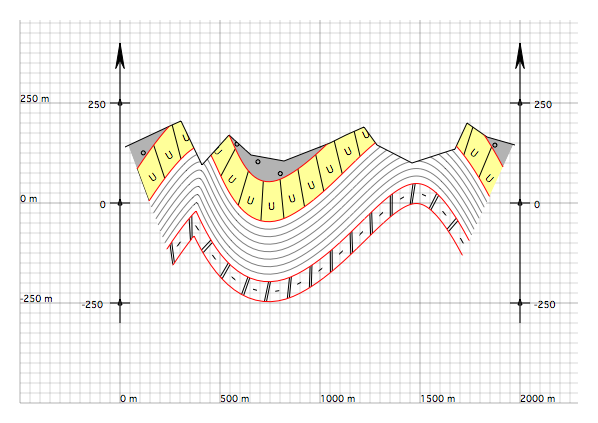
Figure 1 : Geological cross-section with the vertical scale multiplied by two relative to the horizontal scale. The horizontal scale is 1:50,000, whereas the vertical scale is 1:25,000. Recall that one large square on the screen corresponds to a square of 1 cm on paper. This figure may be compared with the original undeformed version.